Cedar County file review
Authority, identity, condition, access, configuration, equipment, custody, capacity, reporting, and destination remain assignment-specific.
Cedar County lender coverage
Lenders Recovery Service provides lender-directed repossession and collateral recovery in El Dorado Springs, Missouri. Start a business inquiry to review assignment fit.
Service-area coverage only. Lenders Recovery Service does not claim a staffed office or public storefront in El Dorado Springs.
Local assignment orientation
El Dorado Springs is evaluated as part of LRS's connected Missouri-and-Kansas operating region. A lender can use this page to identify the general jurisdiction, route context, applicable recovery paths, and secure next step before transmitting protected file information.
Assignment fit in context
El Dorado Springs, Missouri falls within the LRS lender-recovery service area. That is a direct coverage confirmation—not a direction to leave this page and check a regional map before discussing the file.
El Dorado Springs has an approved completed-recovery account involving a 2018 flatbed equipment trailer in an equipment yard near the edge of town. Since its current configuration differed from the lender’s original description, requiring additional condition documentation and recovery planning, the example demonstrates why the first useful inquiry identifies the collateral family, setting, and exception—not merely the ZIP code.
To move from a geographic yes to an operational decision, identify the authorized institution, broad county context, asset class, known movement or access problem, custody status, and destination type. Protected debtor, account, VIN, plate, serial, and exact-location data must wait for the approved channel. The local screen also asks the lender to use U.S. 54 through El Dorado Springs only as orientation and to follow this intake cue: Wait for a current fit decision and approved secure handoff before transmitting a live assignment.
Authority, identity, condition, access, configuration, equipment, custody, capacity, reporting, and destination remain assignment-specific.
Use business identity, broad geography, collateral family, general condition or access, and destination type; keep protected file data in the approved secure channel.
El Dorado Springs, Missouri is within LRS coverage for authorized lender repossession and collateral-recovery inquiries.
A completed flatbed equipment trailer recovery supplies city-specific operating evidence without exposing the lender, consumer, identifier, or exact address.
Coverage is already confirmed: Contact LRS to evaluate the individual assignment—not merely to ask whether El Dorado Springs is served. Public contact must exclude debtor, account, VIN, serial, plate, exact-location, access-code, credential, and legal-document data.
Documented local recovery
A lender assignment in El Dorado Springs, MO involved the recovery of a financed 2018 flatbed equipment trailer located in an equipment yard near the edge of town. Before movement, the recovery agent confirmed the secured-party assignment and positively identified the trailer through the lender’s approved information. Its current configuration differed from the lender’s original description, requiring additional condition documentation and recovery planning.
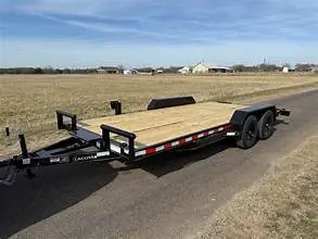
The agent photographed visible condition, checked clearance, and adjusted the recovery method to the equipment actually present. Trailer and equipment repossession in El Dorado Springs, MO can involve farm machinery, work trucks, construction equipment, and lender-secured trailers throughout Cedar County. Once a workable recovery path was established, the trailer was connected and secured appropriately.
The El Dorado Springs recovery was completed successfully, and the collateral was transported to Lenders Recovery Service’s secure Kansas City facility. Arrival photographs, condition notes, and custody documentation were added to the lender file before recovery confirmation was provided.
This documented account omits the lender, consumer, account, VIN or serial number, exact recovery address, and protected field instructions.
El Dorado Springs assignment considerations
MoDOT's El Dorado Springs map identifies U.S. 54, Routes 32 and 82, Route H, and the municipal airport as public references. An edge-of-town yard still requires an asset-specific review of a flatbed trailer's current deck and axle configuration, hitch, tires, brakes, load status, clearance, and receiving destination.
For a flatbed equipment trailer whose configuration has changed, identify deck length and width, axle count, hitch, brakes and tires, ramps or added equipment, load status, yard clearance, and destination. This is a coverage-screening cue, not a request for a precise location or a public equipment recommendation.
Read the owner-approved El Dorado Springs recovery together with U.S. 54 through El Dorado Springs and Missouri Routes 32 and 82 orientation as two separate evidence types: one completed local record and one public geographic reference. Neither selects a route, promises acceptance, or predicts timing or outcome for another assignment.
Missouri Routes 32 and 82 orientation adds city-specific public orientation while the actual origin, lawful access, and travel plan remain protected and assignment-specific.
For a flatbed equipment trailer whose configuration has changed, identify deck length and width, axle count, hitch, brakes and tires, ramps or added equipment, load status, yard clearance, and destination.
Route H and airport-area context describes public setting only. The documented recovery establishes completed local work without identifying a lender, consumer, asset identifier, exact location, or field instructions.
Small-market equipment recovery
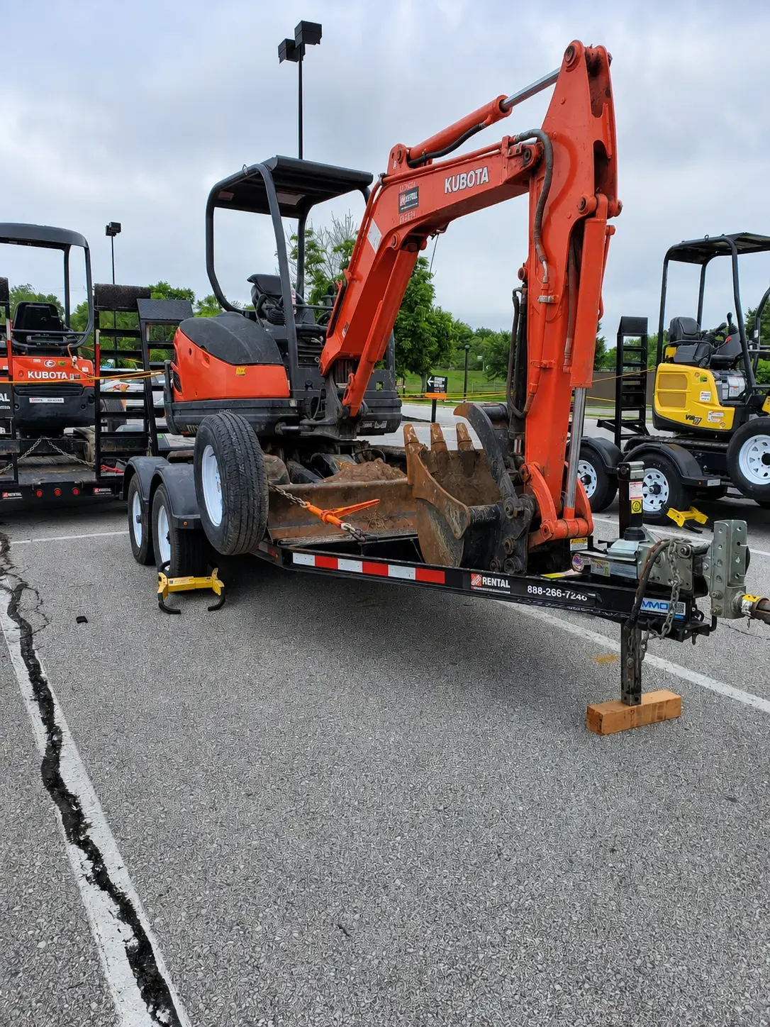
Each El Dorado Springs repossession request is evaluated by Lenders Recovery Service according to the secured asset, known condition, general access setting, and lender instructions. Tractors, implements, skid steers, compact excavators, loaders, work trucks, and trailers can require different equipment, securement, and transport decisions; that assessment is specific to El Dorado Springs.
The useful local distinction is not simply the city name: U.S. 54 through El Dorado Springs, Missouri Routes 32 and 82 orientation, and connected Cedar County roads can present very different access conditions. This small-market knowledge helps LRS plan responsibly while the lender's authority, the present condition, lawful access, and current capacity control the decision; the El Dorado Springs decision remains assignment-specific. The lender gains a clearer El Dorado Springs feasibility review before committing protected information or destination instructions.
A lender with collateral in El Dorado Springs can call 816-533-3565 to discuss assignment fit before sending protected data. Review equipment-recovery capability.
Regional orientation
El Dorado Springs is represented by U.S. Census Gazetteer place GEOID 2921502. Its official representative point is approximately 91.4 straight-line miles from the approved Kansas City coverage-map center. That measurement and Cedar County establish broad geography only; they do not choose a route, prove access, establish timing, or guarantee acceptance.
Verified local basis: The 2025 Census Gazetteer and current Census geocoder support the city, state, representative point, distance calculation, and county context. The cited transportation or municipal source adds public city-specific orientation. The documented recovery on this page provides separate owner-approved evidence of completed local work. LRS does not claim a local branch, dedicated unit, response time, or guaranteed result.
The following corridors provide geographic orientation for a lender evaluating El Dorado Springs. They do not disclose field strategy or promise a specific route, response time, or result.
El Dorado Springs geographic planning
LRS uses the general city, county, corridor, collateral class, and lender instructions to evaluate operational fit. Exact collateral locations and consumer information remain outside the public website.
An inquiry involving El Dorado Springs is first associated with Cedar County and Missouri so the correct geographic and assignment context is established before secure intake.
This corridor anchors the page's regional orientation. Actual field routing is determined only after authority, location, access, collateral condition, and current operations are reviewed.
El Dorado Springs coverage connects with Butler, MO, Fort Scott, KS, Clinton, MO. These links help lenders evaluate related assignments without implying separate LRS offices in those communities.
Assignment considerations
These are review topics for an individual file. Describe the general condition, access, configuration, or destination requirement in your business inquiry; use the approved client channel for protected details.
Services available for review
For service-fit review, provide your institution, the general city or county, and the collateral category. Send protected assignment details only through the approved client channel.
Secure lender intake
The initial conversation should establish business identity, broad geography, collateral category, and the appropriate secure channel. It should not expose a protected assignment file.
Identify the authorized institution, El Dorado Springs or broader Cedar County geography, and general collateral family.
For a flatbed equipment trailer whose configuration has changed, identify deck length and width, axle count, hitch, brakes and tires, ramps or added equipment, load status, yard clearance, and destination.
Wait for a current fit decision and approved secure handoff before transmitting a live assignment.
Keep debtor, account, VIN, serial, plate, exact-location, access, credential, and legal-document data out of public contact.
Protect assignment data: Do not submit VINs, account numbers, debtor details, precise collateral locations, or court documents through the public form or general email. Review assignment data-security guidance.
Lender decision resources
These resources explain the relationship, intake, documentation, and protection steps that apply after a lender identifies the correct geographic page.
El Dorado Springs lender questions
It establishes owner-approved evidence of completed local recovery work while withholding the lender, consumer, account, vehicle identifier, exact location, and protected field instructions. It does not represent a staffed office, public storefront, storage yard, dedicated local unit, response-time promise, or guaranteed outcome. LRS evaluates each new request separately.
The defining decision is to identify the asset family and the broad custody, equipment, and destination questions before choosing a recovery path. Start with business identity, broad El Dorado Springs or Cedar County geography, the asset family, high-level condition and custody, and the destination category.
Cedar County is the published county context for this page. Confirming the actual city, county, and state prevents a broad place name from being mistaken for authority, access, a chosen route, or acceptance.
Send only the institution, authorized business contact, broad city or county, general asset family, high-level condition or access category, and destination type. Protected assignment data must wait for the approved secure client channel.
Connected regional coverage
Nearby pages provide additional county, corridor, and lender-intake context for assignments that fall outside the immediate El Dorado Springs area.
Assignment-specific confirmation
Start with your institution, business contact information, Cedar County, and the general collateral class. LRS will identify the appropriate next step before protected details are exchanged.